01
Abstract feedback
People may say “make it greener” or “make it safer,” but different participants can imagine very different outcomes.

Real-time participatory urban design
Street Cloud transforms community input into visual street-design scenarios, creating a shared feedback loop between people, planners, and the places they are shaping.
No app installation required. Join through a QR code and contribute from a phone.
An interface between public participation and urban-design visualization— not just an AI image generator.
Why Street Cloud
Planning workshops generate valuable knowledge. Yet much of that knowledge is captured through conversations, sticky notes, forms, and written feedback— leaving participants to imagine spatial consequences without seeing them. Street Cloud shortens the distance between what people say and what everyone can see and discuss together.
People may say “make it greener” or “make it safer,” but different participants can imagine very different outcomes.
Workshop information may need to be manually coded, analysed, mapped, and visualized after the event.
Technical plans and drawings can be difficult for non-specialists to interpret.
Participants may provide input but never see how their contribution influences the design conversation.
The feedback loop
A shared visual loop where community preferences can be captured, interpreted, visualized, and discussed within the same participatory environment.
How it works
Scan. Share. Visualize. Discuss. Street Cloud turns participation into a live, visible design conversation.
Step 01
Participants join the session by scanning a QR code. No specialist software or design knowledge is required.
Live product interface
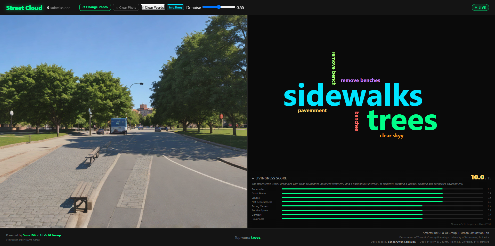
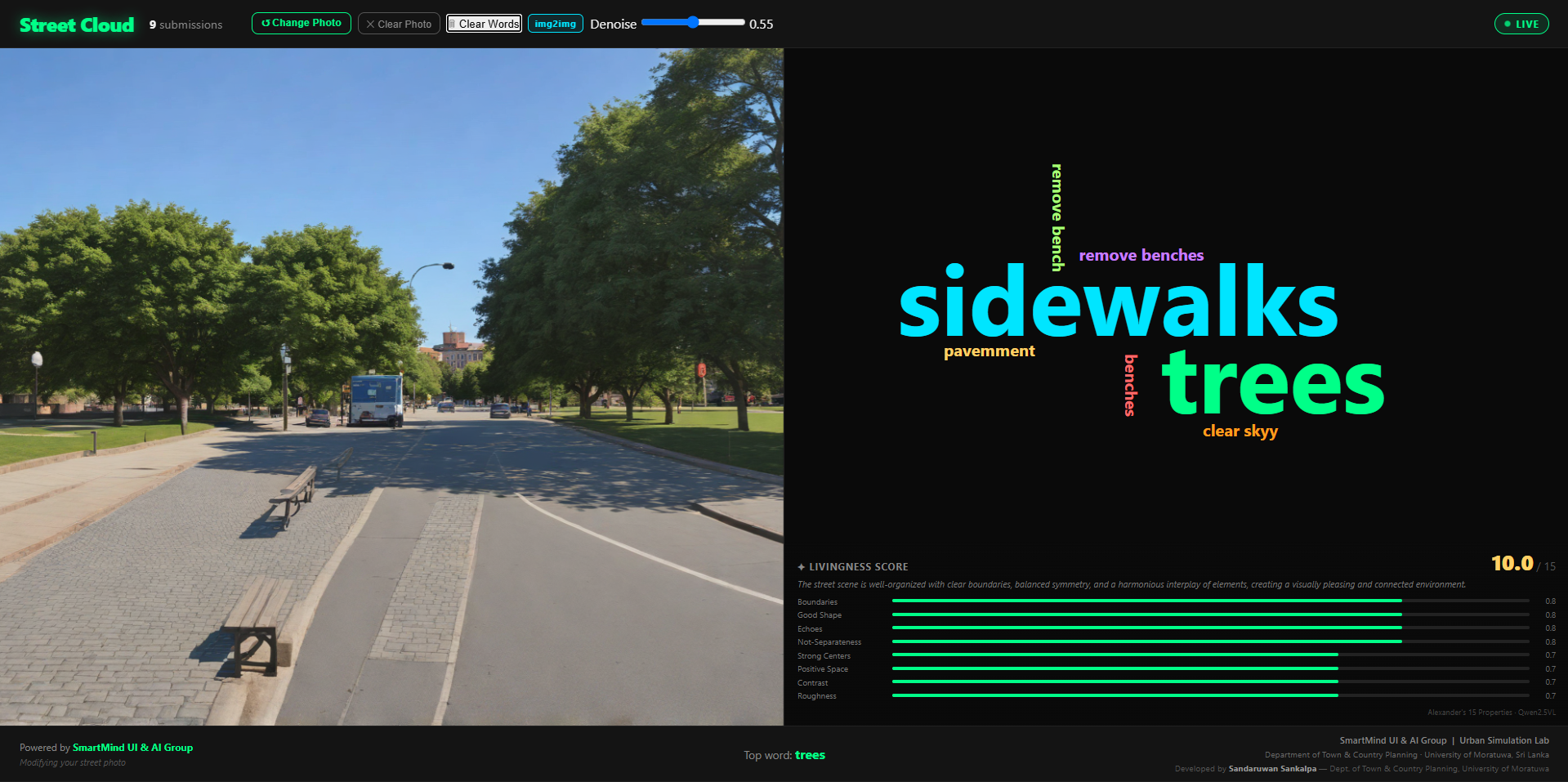
Participants contribute through phones while facilitators manage the session from a shared Street Cloud display.
Live Co-Design Session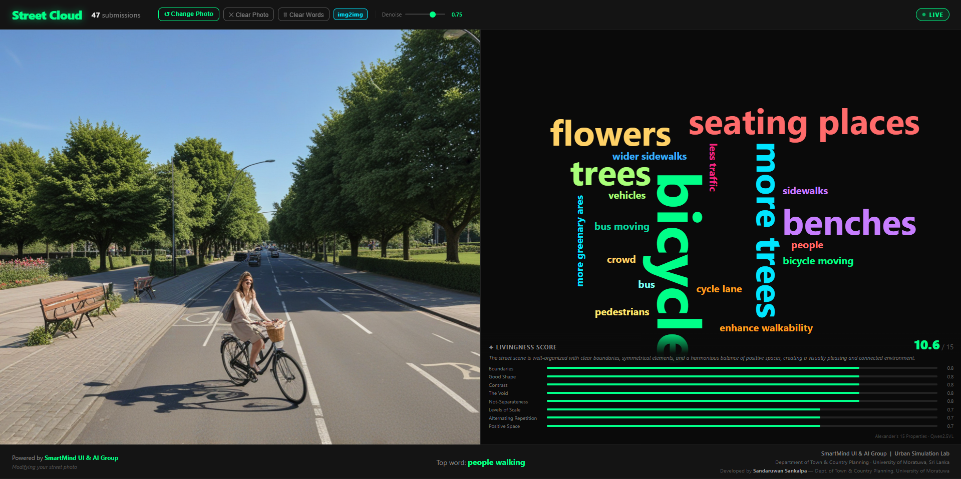
Product showcase
An existing street scene becomes the starting point. Participants interact through phones while the shared display responds to collective preferences— the full interaction cycle, not just a finished AI image.
The session begins with a recognizable image of the actual place.
Before / after
Conceptual AI-assisted visualization generated from selected participatory design priorities. Drag to compare.
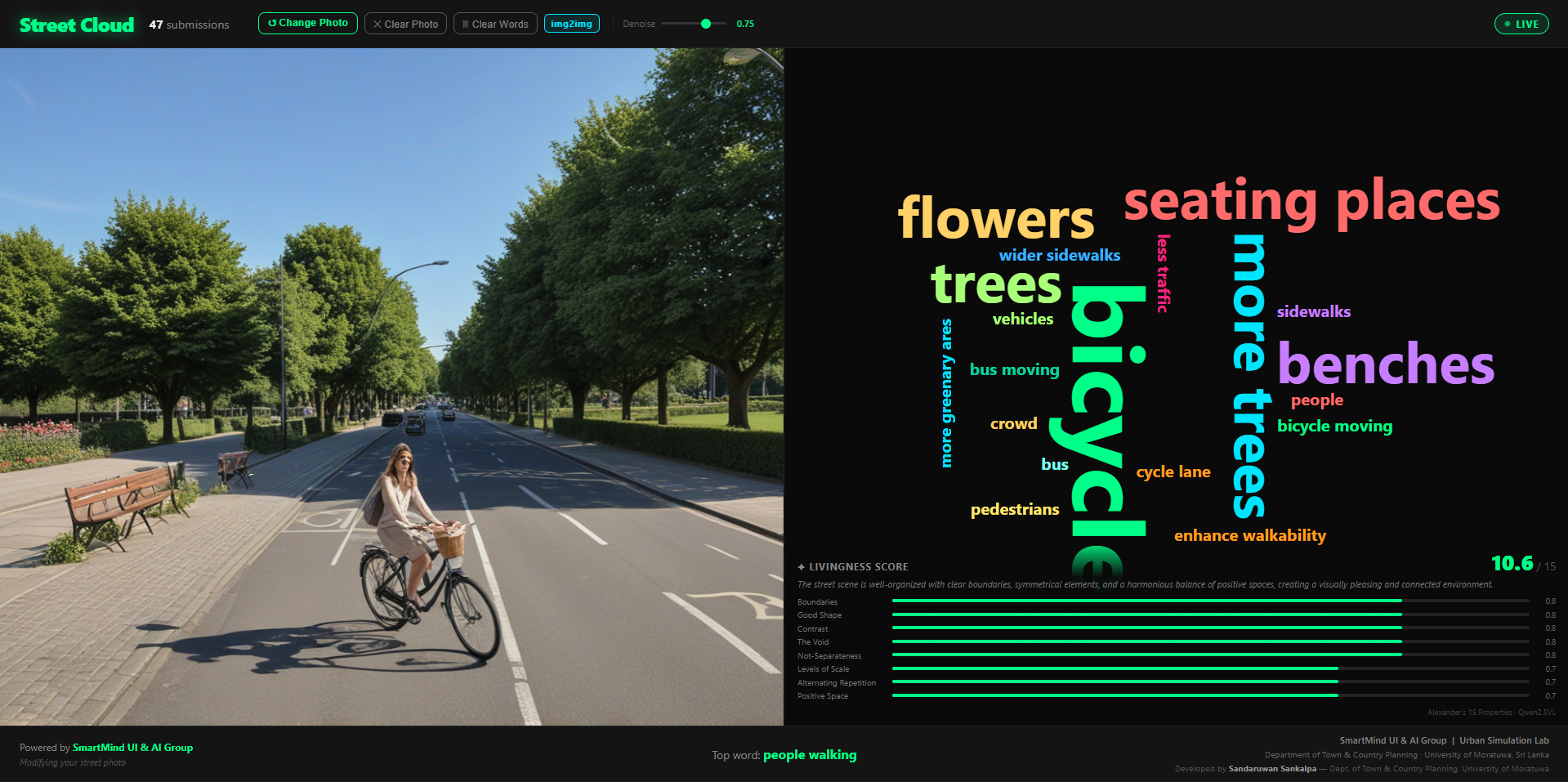
Conceptual visualization for participatory discussion—not an engineering drawing.
Interactive demo
Choose design priorities and simulate how Street Cloud surfaces a community scenario. This website demonstration uses prepared assets—not the live generation engine.
Interactive website demonstration using prepared Street Cloud scenarios.
Core features
The distinctive value is not any single feature—it is the connection between participation, structured interpretation, visual scenarios, and shared discussion.
Join live engagement sessions directly from a phone—no app install required.
Contribute through buttons, sliders, free text, voice, and reaction voting.
Repeated inputs organize into collective themes and visible design priorities.
Start from an image of the actual street so people discuss a place they recognize.
Translate design signals into conceptual street alternatives for discussion.
Turn isolated survey submission into a collective conversation in the room.
Explore greener, walkable, mobility-focused, or balanced alternatives of the same street.
Open sessions, moderate input, generate scenarios, compare alternatives, and export summaries.
Scenario gallery
Street Cloud is about exploring alternatives—not generating one “correct” answer.
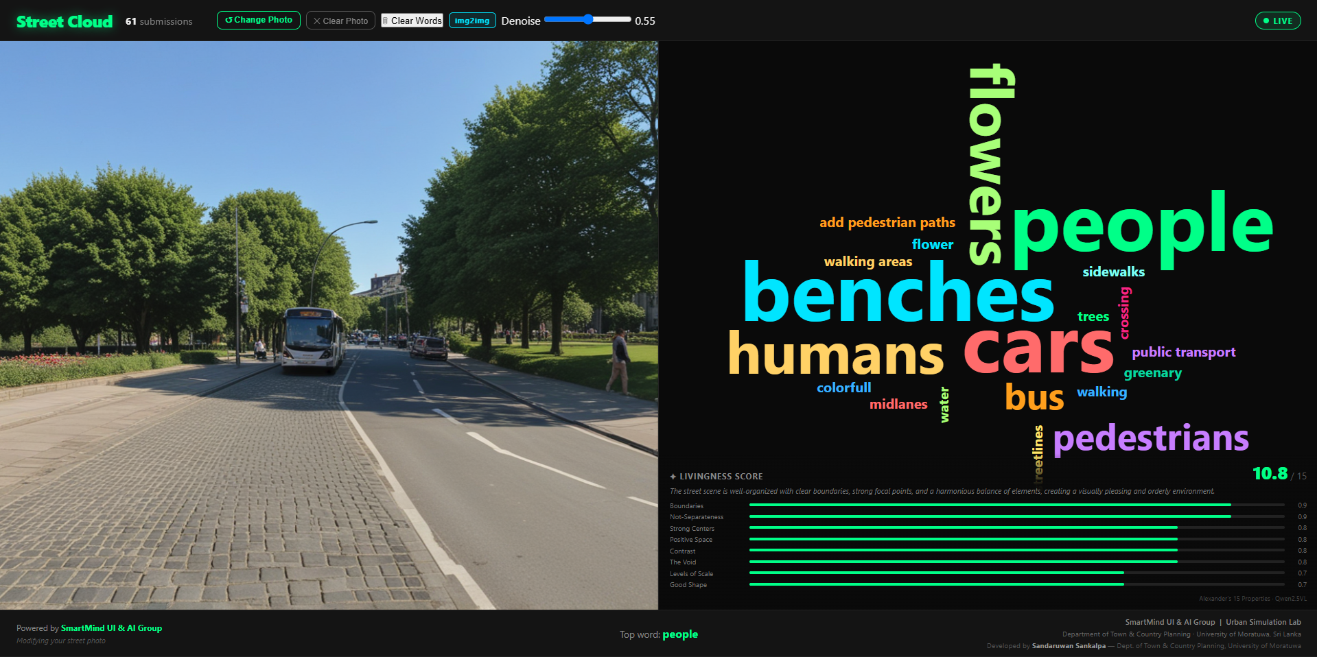
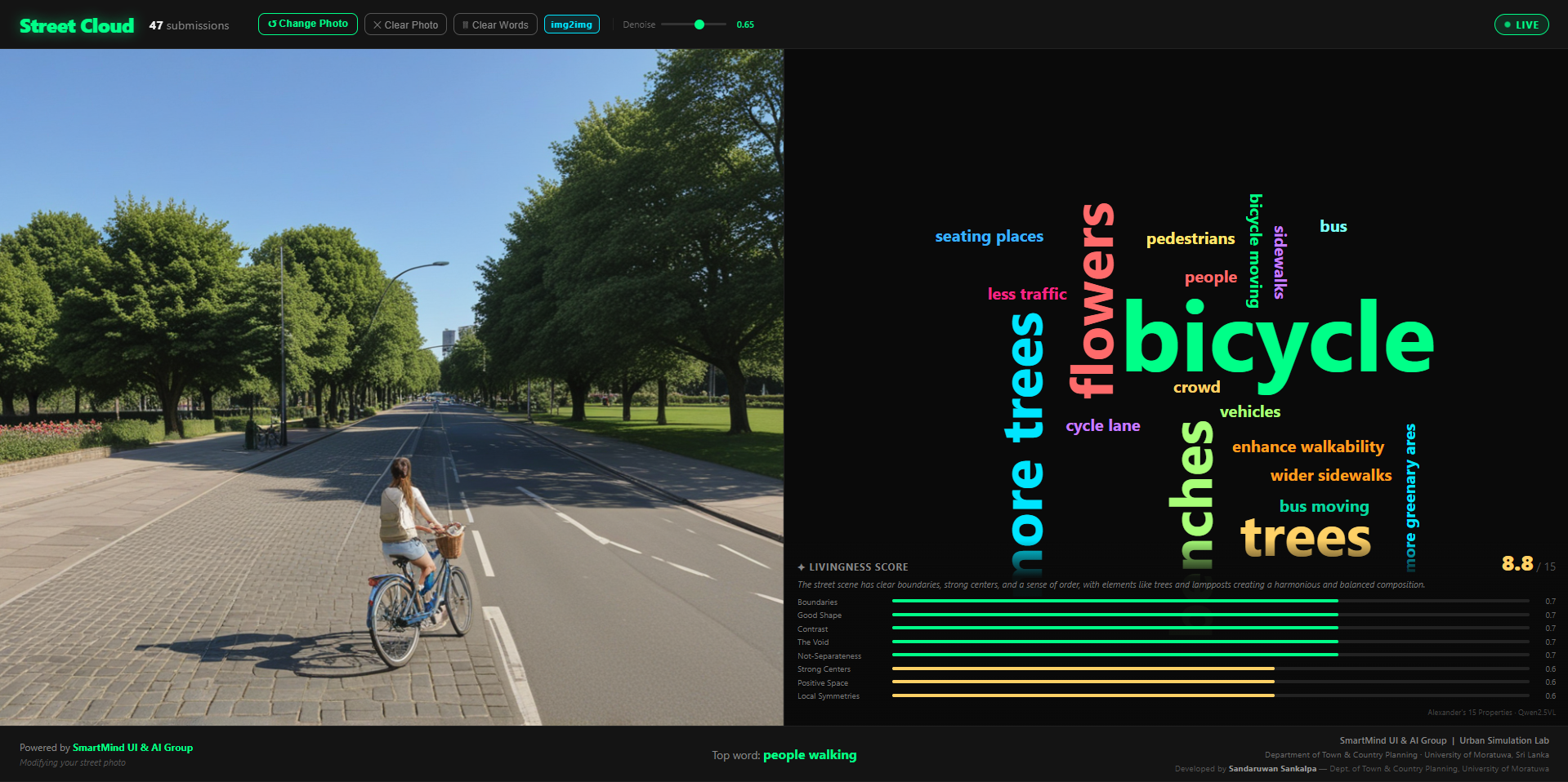
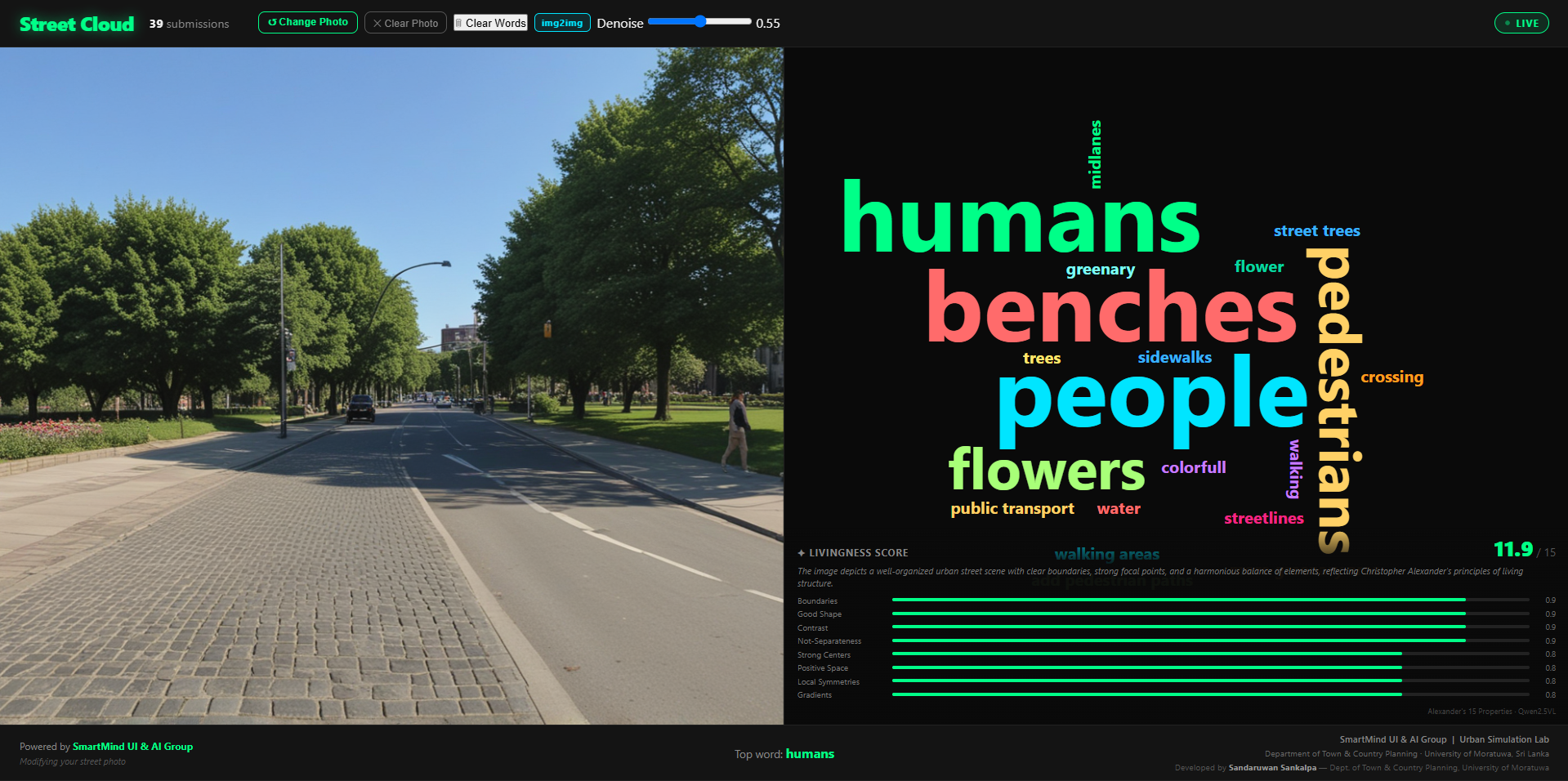
Use cases
From participatory street redesign to university studios—Street Cloud supports conversations where spatial ideas need to become visible.
Engage residents in exploring sidewalks, trees, crossings, parking, and public space.
Use visual scenarios in community meetings to make proposed changes easier to understand.
Let students, stakeholders, and communities explore design priorities together.
Visualize temporary interventions before physical implementation.
Support early-stage discussion about streetscape and public-realm transformation.
Study participatory planning, visual preference, and human–AI collaboration.
System architecture
Four layers—participation, interpretation, scenario, and visualization— connected so feedback can loop back into the room.
QR / text / voice / preference controls
Cleaning, moderation, intent extraction
Trees ↑ · Walkability ↑ · Parking ↓
Existing context + parameters + priorities
AI-assisted conceptual output
Compare, discuss, refine
Philosophy
Street Cloud generates visual scenarios to support discussion. It does not determine which design should be built. Community preferences can conflict. Accessibility, safety, transport performance, cost, climate, regulation, maintenance, and professional judgement remain essential.
AI in Street Cloud
Inputs originate from participants and facilitators. Professional planning and design judgement remains necessary to interpret feasibility, safety, regulation, cost, and implementation.
People define priorities. Professionals retain judgement.
The existing place remains the visual reference.
Outputs can be revised as the conversation evolves.
Generated imagery is clearly identified as a conceptual scenario.
Visualizations are not engineering or construction documents.
Research
Street Cloud is grounded in digital planning tools, participatory planning, urban informatics, visualization, and AI-assisted design.
How can communities engage meaningfully with spatial decisions?
How can digital tools improve exploration of planning alternatives?
How can real-time digital interaction support urban understanding?
How can AI support—not replace—design discussion?
How can design ideas become understandable to non-specialists?
How can many contributions become shared priorities?
Developed in connection with the Urban Simulation Lab, Department of Town & Country Planning — University of Moratuwa, Sri Lanka, and the SmartMind UI & AI Group.
Limitations
Honesty builds credibility. Street Cloud is most useful as an engagement and scenario-exploration interface, not as a replacement for professional design and planning processes.
FAQ
Street Cloud is a research-driven prototype exploring participatory street design—not an automated planning authority.
Street Cloud is a participatory urban-design platform that converts community input into visual street scenarios during an engagement process.
Street Cloud uses AI-assisted visualization, but the product is broader than image generation. Its core purpose is to connect participation, design priorities, visual scenarios, and discussion.
No. The intended workflow uses browser-based participation accessed through a QR code.
No. Street Cloud produces conceptual design scenarios for discussion and exploration. Final planning and design decisions require professional and technical review.
Yes. The product is designed around existing-place imagery so participants can discuss transformations of a recognizable location.
Voice input is part of the intended multi-modal participation workflow and can be converted into structured design signals.
Yes. Multiple scenarios can be explored using different combinations of community priorities and design parameters.
No. Participation data should inform discussion, not automatically determine the final planning decision.
Yes. The platform can support studies relating to participatory planning, visual communication, human–AI collaboration, and urban informatics.
Street Cloud is currently being developed and demonstrated as a research-driven prototype. Selected pilot and collaboration opportunities are being explored.
Explore Street Cloud for participatory workshops, research collaborations, urban-design demonstrations, and pilot projects.
Request a demo
We are interested in conversations with planning authorities, municipalities, researchers, universities, urban designers, community-engagement teams, and innovation partners.
Explore Street Cloud for participatory workshops, research collaborations, urban-design demonstrations, and pilot projects.
What would your street look like if everyone could help shape it?